Its attractions include unique landscapes, evergreen forests, cold deserts, snowcapped mountains, and a great cultural heritage. Gilgit Baltistan is a famous tourist destination and has always been a paradise for mountaineers, trekkers, and landscape-loving people.
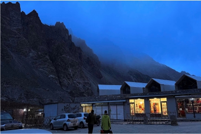
Gilgit City is the capital city of the Gilgit-Baltistan region. It is the hub of main markets, airports, restaurants, and hotels for tourists and nature lovers.
Gilgit city consists of Sunnis, Shias, and Ismails almost in the same ratio.
There are many good restaurants with good taste, like Indus Lodges, Paradise Grill, and Gilgit Cafe. In the main city of Gilgit, there is also fast food and continental Pakistani food available.
There are many hotels and resorts available at Gilgit City. Book these scenic hotels in advance. Here is the list of some hotels:
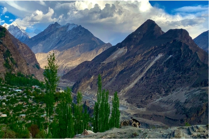
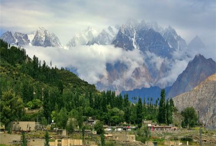
Yes, Hunza Valley is the scenic town and district of Gilgit-Baltistan. Hunza Valley is 3 hours far away from the main Gilgit city. Local transport is also available to reach Hunza from Jutial Gilgit. You can hire a private car or Prado to travel from Gilgit to Hunza Valleys.
NLI market is the largest market of Gilgit Baltistan where you can buy any type of goods and commodities of your daily life.
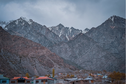
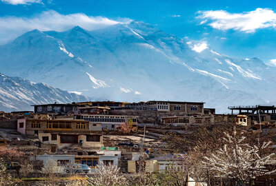
Gilgit is located at an altitude of approximately 1,500 meters (4,800 feet) in the Northeast of Pakistan. The city had been a central point of trade and political activity as early as the 1st century AD. Since then, it has always been a very strategic point for the neighboring countries. Surrounded by the massive mountains of the Karakorums, Gilgit is a small valley with just enough land to support a city of 500,000 people. Beyond that, there is no such big town or city in any direction within a distance of about 450 Kilometers. Gilgit is the administrative and commercial capital of the Northern areas.
The mountains of the region are known to be the highest and most numerous in the world. The stretch of Gilgit lies in the rain shadow of Nanga Parbat, i.e., the winds are blocked by the mass of Nanga Parbat, and clouds cannot reach Gilgit, which makes it dry & rugged. The labor of the strong and willing local population has even claimed the hard mountains for cultivation. As a result, there are beautiful green orchids and many fruits in the valley. This makes a spectacular contrast in the green fields and ruggedness on the mountains topped with white snow a scenery only found in the northern areas of Pakistan.
The road to Gilgit is another adventure- and beauty-filled experience: the Karakorum Highway, built between 1966 and 1978 by Chinese and Pakistani engineers, above the shoulders of the gigantic mountains of the Himalayas, Hindukush & Karakorum ranges. More than five hundred lives are buried under this marvelous road, which is known all over the world for its beauty and variation in terrain and culture. The highway runs along the Indus River and later continues to Gilgit on the Gilgit River.


